Weather service adjusts storm risk
Published 1:35 pm Wednesday, April 10, 2024
|
Getting your Trinity Audio player ready...
|
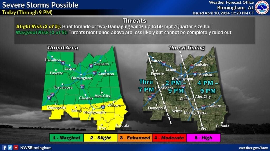
At around 1 p.m., the National Weather Service in Birmingham made adjustments to this afternoon’s severe storm risk based on latest convective trends on radar, and through assessment of the mesoscale environment.
Lowndes County Public Schools closed at 1 p.m. and will let faculty go around 2 p.m. The Lowndes County Policy Council rescheduled its regular meeting today, setting the new day for April 17 at 3 p.m.
The unstable air is really struggling to move inland due to the thunderstorm complex along the coast, and east-southeasterly surface winds. Some risk of a few strong storms will continue this afternoon near and south of the Interstate Highway 85 corridor with much lower potential across the northern two-thirds of the area.
Early Wednesday morning, the weather service predicted a corridor of heavy rainfall would reach southwestern portions of the area around noon then become more widespread through the remainder of the afternoon. The main flooding concern will be across the southern portions of the area where 2 to 4 inches of rainfall accumulation is expected.
If the environment is able to destabilize enough amidst the widespread rain, the greatest potential for some strong to severe storms is expected to develop across the far south/southwest this afternoon.
Pioneer Electric reminds members to stay weather alert and call 1-800-533-0424 or text PEC to 382-6636 to report a power outage.